Introduction to the Greenland Map
The Greenland map is not just a simple representation of this vast, icy territory; it is a crucial tool for researchers, adventurers, and policymakers. It showcases Greenland’s geographical features and highlights its significance in the context of climate change, geopolitics, and Arctic exploration. As the effects of global warming become increasingly evident, understanding Greenland’s geography is essential for environmental management and scientific studies.
Geographical Features of Greenland
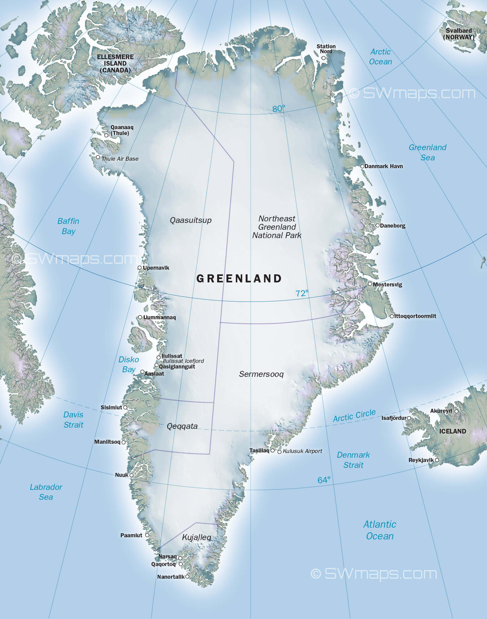
Greenland is the world’s largest island, and its map reveals an extensive terrain comprising vast ice sheets, mountains, and fjords. The Greenland Ice Sheet, which covers roughly 80% of the island, is one of the most significant features highlighted on the map. Recent studies have indicated that this ice sheet is melting at an alarming rate due to rising temperatures, emphasising the importance of accurately mapping and monitoring these changes. Greenland’s map also illustrates its rugged coastline, numerous islands, and the Arctic Circle, providing a holistic view of its geography.
Recent Developments in Mapping Technology
Advancements in mapping technologies, such as Geographic Information Systems (GIS) and satellite imagery, have greatly enhanced the accuracy and detail of the Greenland map. In recent years, the European Space Agency and NASA have collaborated on projects that provide updated imagery and data on Greenland’s changing environment. These efforts not only support scientific research but also allow policymakers and the public to understand the pressing issues facing the region. For example, local communities are increasingly using updated maps to plan for changes in sea level and potential impacts on their livelihoods.
Conclusion and Future Implications
The Greenland map is a vital resource that serves various purposes in today’s world. As geopolitical interest in the Arctic increases, particularly due to natural resource exploration, it becomes crucial to keep the map current. The melting ice sheets could also reveal previously undiscovered territories and resources, highlighting the need for comprehensive studies and updated maps. For researchers and environmentalists, tracking these changes will be key to understanding the broader implications of climate change. The Greenland map, therefore, is not just a static image; it is a dynamic tool that reflects the ongoing transformations in one of the world’s most remote and fascinating regions.