Impact of Recent Weather Conditions
The recent severe weather in Atlanta has resulted in significant impacts, including a wind advisory currently in effect across North and Central Georgia until 8 p.m. Thursday. Wind gusts are expected to reach up to 35 mph, posing risks of downed trees and power outages due to the saturated ground from heavy rains earlier in the week.
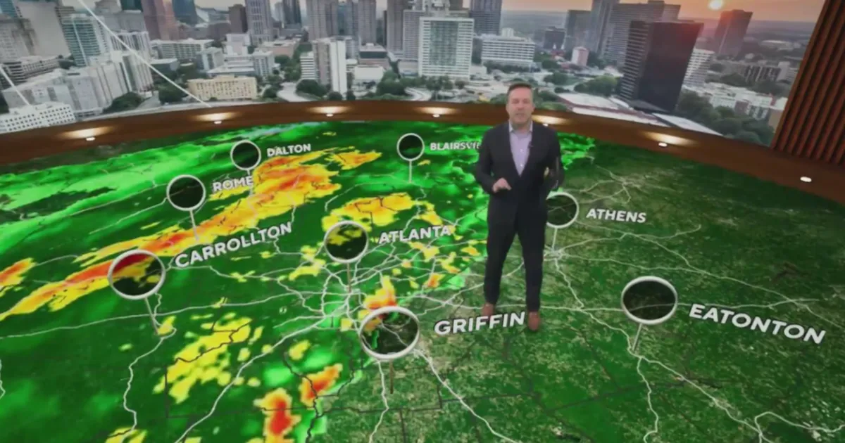
A line of strong to severe thunderstorms swept across Georgia, prompting tornado warnings and watches. During these storms, wind gusts approached 60 mph, raising concerns for safety and property damage.
In response to the severe weather threat, several school systems, including the Meriwether County School System, Troup County School System, and Rockdale County Public Schools, announced two-hour delays for the start of classes.
Current Weather Conditions
As of now, the tornado watch for central and east-central Georgia has expired, but light rain is expected to continue for several hours in areas east of Interstate 75. Residents are advised to remain cautious as the ground remains unstable.
The National Weather Service reported that strong storms swept across Georgia early Thursday, leading to the current advisories and warnings. The combination of high winds and saturated ground conditions has created a precarious situation for many communities.
Looking Ahead
Looking forward, another weather system is anticipated to bring additional thunderstorms to the region from Sunday into Monday. Residents are encouraged to monitor updates as the situation develops.
Details remain unconfirmed regarding the extent of potential impacts from the upcoming weather system, but the community is urged to stay prepared and informed.


