Severe Weather Conditions Expected
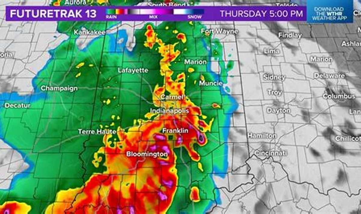
A tornado watch has been issued for most of the Indianapolis area until noon on March 11, 2026. Residents are urged to remain vigilant as severe storms and damaging winds are forecasted to impact central Indiana throughout the day.
The National Weather Service has indicated that thunderstorms will be capable of producing damaging straight-line winds, large hail, very heavy rain, and isolated tornadoes. High temperatures are expected to reach 69 degrees Fahrenheit, dropping to a low of 31 degrees overnight. Rainfall could accumulate to as much as 2 inches during the day, raising concerns about flooding in the region.
Wind and Temperature Changes
Wind gusts are predicted to reach between 45 to 50 mph outside of storm activity, contributing to the hazardous conditions. Following the passage of a cold front, temperatures are expected to drop significantly, with a high of only 49 degrees forecasted for March 12, 2026.
Emergency Preparedness
In light of these severe weather conditions, Marion County residents can sign up for emergency alerts by texting MESAINDY to 67283. This is particularly crucial during Severe Weather Preparedness Week, which runs from March 8 to March 14, 2026, emphasizing the importance of being ready for potential weather emergencies.
Indiana has a history of severe weather, having experienced 62 tornadoes in 2025, marking the second-highest number recorded since 1950. This context underscores the need for residents to stay informed and prepared as they face the possibility of severe storms and tornadoes.
What to Expect
As the day progresses, observers are closely monitoring the situation. The National Weather Service advises residents to ensure they have a means to receive alerts and to have their severe weather plans ready to implement. Details remain unconfirmed regarding the exact impact of the storms, but the potential for severe weather remains high.


