Tornado Watch in Effect
A tornado watch is in effect for the Kansas City metro area until midnight, as severe weather conditions develop across the region. Additionally, a tornado watch has been issued for all of Michiana until 2 a.m. Wednesday.
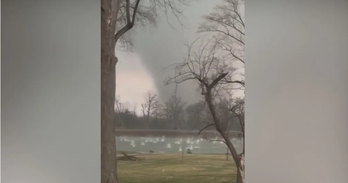
In Illinois and Indiana, a tornado watch is active for Ford, Grundy, Kankakee, LaSalle, Livingston, and Iroquois counties until 11 p.m. Reports indicate confirmed tornadoes have already been sighted over parts of northwest Indiana, raising concerns among local residents.
A tornado warning is currently in effect for La Porte County, Indiana, until 9 p.m., while a severe thunderstorm warning is also in place for several counties in Illinois and Indiana until midnight. The National Weather Service has emphasized the seriousness of the situation, stating, “A tornado watch means there are weather conditions that could lead to the formation of severe storms and tornadoes.”
In Kankakee, Illinois, large hail has been reported, measuring as large as 5.2 inches, contributing to the hazardous conditions. The entire Chicago area faces a high risk for flooding and tornadoes through 1 a.m. Wednesday, as meteorologists warn that storms are developing quickly.
Chief Meteorologist Albert Ramon from CBS News Chicago advised, “It is vital that you have multiple ways to receive warnings and be ready to act quickly if a warning is issued.” The potential for wind gusts reaching 70 miles per hour adds to the threat level, which has been categorized as moderate for severe storms.
As the situation evolves, observers are closely monitoring the development of these storms. The main threat with the strongest storms will be damaging wind and locally heavy rainfall that may cause flash flooding. Details remain unconfirmed regarding the full extent of the damage caused by the confirmed tornadoes.


