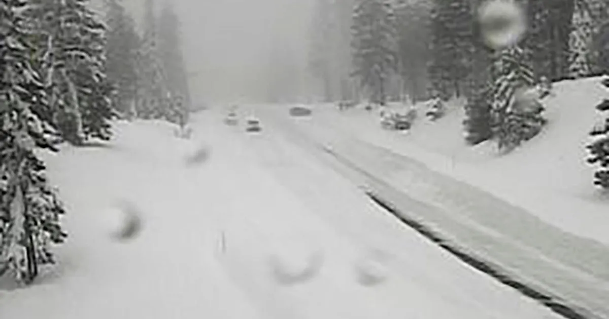
A winter storm warning is currently in effect for the Sierra Nevada, where significant snowfall and hazardous conditions are expected to impact travel and safety. The National Weather Service (NWS) has alerted residents to the potential for additional snow accumulations of 12 to 18 inches above 4500 feet, with the highest peaks possibly receiving up to 2 feet of snow.
Wind gusts are also a concern, with speeds reaching as high as 45 mph, which could exacerbate the already treacherous conditions. The warning is set to last until 11 PM PDT on April 12, urging travelers to reconsider their plans.
The UC Berkeley Central Sierra Snow Lab reported nearly eight inches of snow on April 11, setting the stage for this late-season storm. The NWS had initially issued a winter storm watch for the region on April 10, indicating the potential severity of the weather.
Officials have emphasized that travel is highly discouraged due to slick road conditions, and those who must travel are advised to use extreme caution. Visibility may drop below a quarter mile, leading to dangerous whiteout conditions.
As the storm continues to impact the region into Sunday evening, residents are left to navigate the challenges posed by this unpredictable weather pattern. The Sierra Nevada is known for its dramatic weather swings, even in April, making this event a notable example of its volatility.
Travelers are advised to delay their journeys if possible, as the combination of heavy snowfall and high winds could create life-threatening situations on the roads. The NWS continues to monitor the situation closely, providing updates as conditions evolve.
With snow accumulations potentially reaching up to 14 inches in some areas, the impact of this storm is expected to be significant. As the situation develops, residents and travelers alike are urged to stay informed and prioritize safety.


