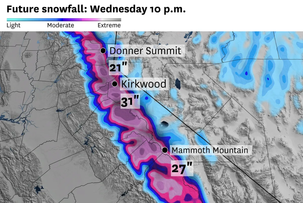
A significant winter storm is set to impact the Sierra Nevada, with forecasts indicating that some areas could receive more than 2 feet of snow. Travel disruptions are anticipated as snowfall rates could reach 1 to 2 inches per hour on Tuesday.
Winter storm warnings and advisories are currently in effect across the region. This is the second such warning issued this month — a notable frequency not seen since 2010. The moisture trajectory of this storm comes from the south, which typically complicates precipitation patterns east of the Sierra crest, as noted by meteorologist Chris Smallcomb.
High-elevation ski resorts may receive up to 3 feet of snow, creating both excitement and concern among local businesses and residents alike. Meanwhile, Interstate 80 and Highway 50 mountain passes are expected to see over a foot of snow, adding to travel woes.
The heaviest snow is projected for Tuesday afternoon and evening, particularly above elevations of 5,000 feet in the northern Sierra and above 7,000 feet in the southern regions. Gusts may reach up to 90 mph atop ridges — a force that could exacerbate already hazardous conditions.
Warnings extend from Lassen National Park all the way to Yosemite, Sequoia, and Kings Canyon national parks. In addition to snow, Northern and Central California may experience half an inch to an inch and a half of rain.
But it’s not just snow causing concern; there’s even a possibility that some of the strongest storms could produce brief tornadoes in the Sacramento Valley on Tuesday, according to forecaster Dave Houk. The unpredictability of winter storms often brings surprises, both good and bad.
As residents prepare for this incoming weather system, they’re reminded that safety should come first — especially when travel is involved. The potential for significant snowfall raises questions about road conditions and accessibility in mountainous areas.
Details remain unconfirmed regarding how long these conditions will persist or what specific impacts might follow after this storm passes. For now, vigilance is key as communities brace for what could be one of April’s most impactful weather events.


