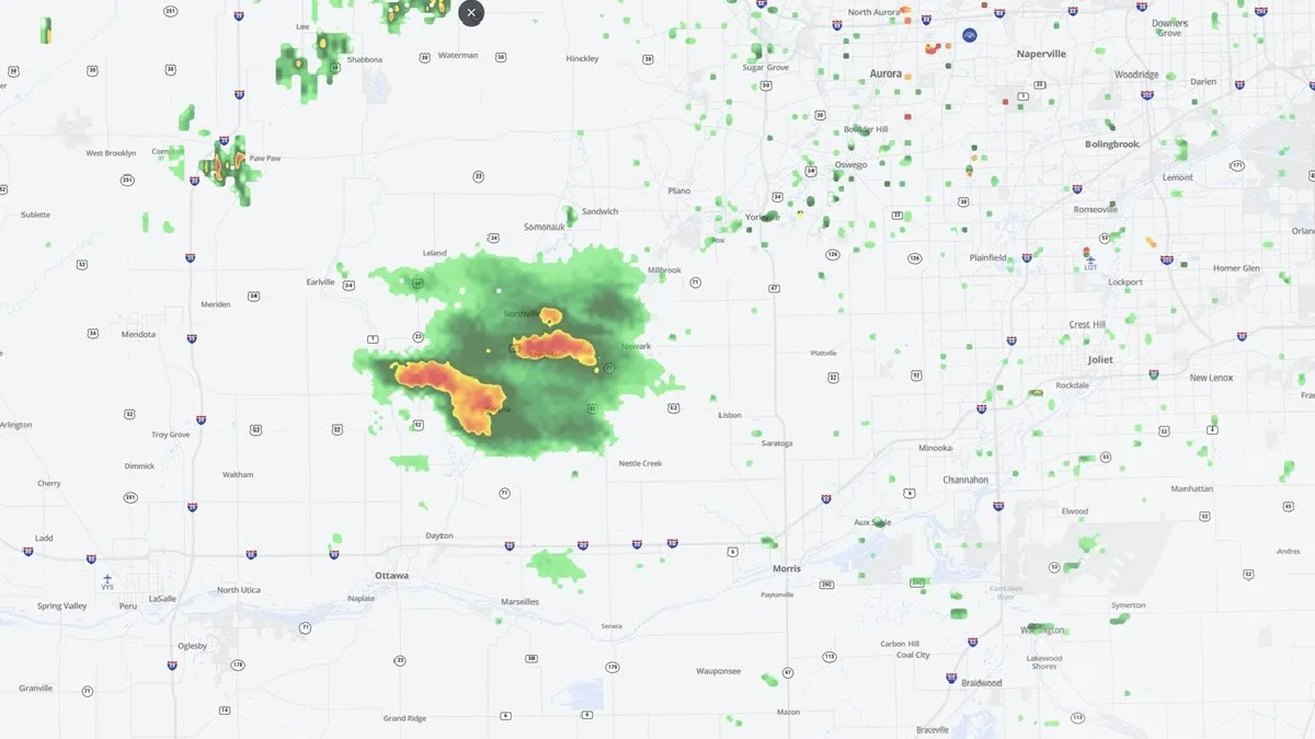
Severe Weather Radar: Chicago Area Faces Elevated Storm Risk
The Chicago area is facing an elevated risk of severe weather on Tuesday evening, March 10, 2026. Intense storms capable of producing tornadoes, large hail, and fierce winds are expected to affect the region.
Grundy, LaSalle, and Will counties have been upgraded to a ‘moderate’ risk for severe weather, while a large part of Cook County is under an ‘enhanced’ risk. Areas near and south of I-80, including Joliet, Frankfort, Morris, and Kankakee, could see the strongest storms.
The earliest chance for showers and storms is anticipated around 3 p.m., with a line of severe weather expected to develop around 7 or 8 p.m. Severe weather is projected to continue through midweek, impacting various regions across the South, Plains, and Midwest.
According to meteorologist Caitlin Kaiser from weather.com, the atmospheric conditions are conducive for severe storms, with CAPE (Convective Available Potential Energy) indicating instability essential for thunderstorm development. Additionally, wind shear is a key ingredient in the formation of these storms.
This severe weather outbreak follows another round of storms that affected the same areas just last week, raising concerns for residents and officials alike. The potential for tornadoes, damaging winds, and large hail remains a significant threat.
As the day progresses, local authorities and meteorologists will continue to monitor the situation closely. Residents are advised to stay updated through reliable weather sources and heed any warnings or advisories issued.
Details remain unconfirmed regarding the exact timing and severity of the storms, but the radar indicates a serious weather event is on the horizon for the Chicago area.