Introduction
Weather radar maps have become an essential tool in meteorology, providing real-time data on weather conditions and helping to predict storms, rainfall, and more. As climate variability increases and extreme weather events become more frequent, understanding how to read and interpret these maps is crucial for communities, businesses, and individuals alike. With accurate weather information, people can make informed decisions to stay safe during severe weather.
What is a Weather Radar Map?
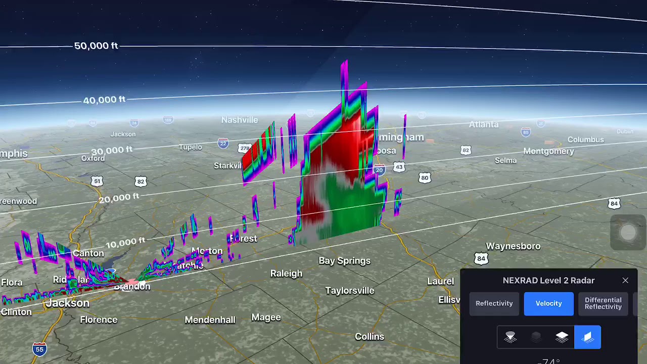
A weather radar map displays precipitation, storm systems, and atmospheric features by using radio waves to detect rain, snow, sleet, or hail. This technology sends out microwave pulses, which bounce back after hitting precipitation particles, allowing meteorologists to determine the location, intensity, and movement of weather systems. The data generated can be viewed in real-time, providing critical updates during severe weather events.
Recent Developments in Weather Radar Technology
Recent advancements in technology have greatly improved the accuracy and effectiveness of weather radar mapping. Doppler radar, for example, can detect the movement of precipitation particles, enabling forecasters to read not only where the rain is falling but also how fast it is moving. This capability is especially beneficial during tornado warnings and flash flood alerts. Additionally, satellite-based radar systems are becoming increasingly popular, providing broader coverage and enhanced detail.
Using Weather Radar Maps Effectively
Interpreting weather radar maps can initially seem daunting, but certain key features can help simplify the process. Colour coding on the maps indicates the intensity of precipitation, with darker shades usually representing heavier rainfall. Meteorological symbols and directional arrows can also signal storm movement, providing a clear picture of approaching weather patterns. Many apps and websites offer user-friendly interfaces that facilitate easier access to these maps, allowing anyone to follow changing weather conditions from their devices.
Conclusion
Weather radar maps are indispensable tools that have revolutionised how we understand and respond to weather phenomena. As we face the growing challenges posed by climate change, leveraging advanced weather radar technologies can save lives and mitigate property damage during extreme weather events. With continued advancements in meteorological technology, the future holds the promise of even more precise and timely weather information, enhancing public safety and disaster preparedness.